COLLECTION NAME:
NASA Earth Observatory Collection
Record
Title:
Rodeo and Chediski Fires in Arizona
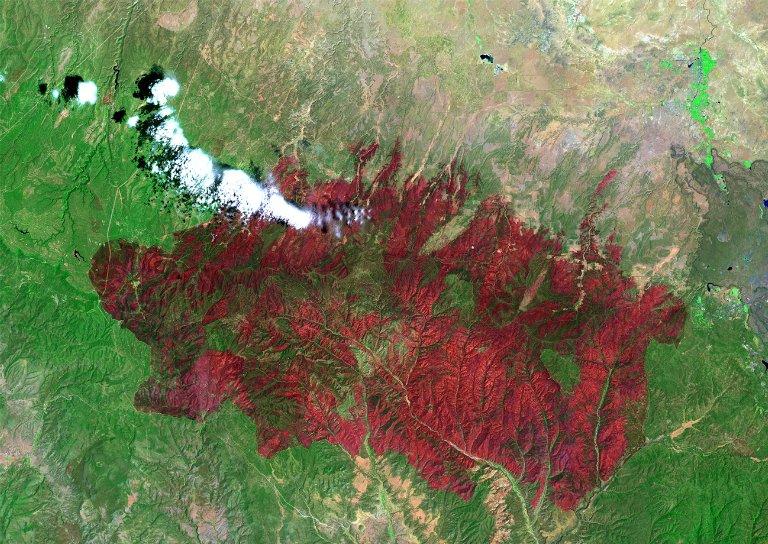
Description:
This image from the Landsat Enhanced Thematic Mapper Plus (ETM+) shows the Rodeo-Chediski Fire on July 7, 2002. The result of two large fires that combined into a single blaze, the fire consumed almost half a million acres, and was the largest and most expensive fire in Arizona?s known history, costing more than $30 million before it was contained. In this false-color image, vegetation appears bright green and burned areas are deep red. Landsat ETM+ captured the fires? succession over three weeks (see links below.) June 21, 2002 June 29, 2002 Image provided by the USGS EROS Data Center Satellite Systems Branch.
Satellite - Sensor:
Landsat 7- ETM+
facet_what:
Landsat
facet_where:
Arizona
facet_when:
July 7, 2002
facet_when_year:
2002
UID:
SPD-ETOBS-4625
Link To Source